Ausable Lake Postcard
$ 0.35
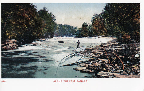
In the shadow of Mt. Marcy, the highest Peak in the Adirondack Mountinas, are Upper and Lower Ausable Lakes. The East Branch of the Ausable River arises out of these lakes and flows through the beautiful Ausable Valley continuing to Au Sable Forks where it joins the West Branch of the Ausable River. The river continues its journey to Lake Champlain, along the way running through the spectacular Ausable Chasm.
The Ausable lakes and river provided world-class trout fishing, scenery, and demanding whitewater paddling opportunities on the upper end of the river. The river also runs through Wilmington Notch, a deep gorge with 700 foot cliffs on one side and 1,700 cliffs on the other side, and forms a natural boundry between Clinton and Essex Counties in New York State. Text: Ausable Lake, Adirondack Mountains. ©2014 R.P. Nadeau. All rights reserved.
The Ausable lakes and river provided world-class trout fishing, scenery, and demanding whitewater paddling opportunities on the upper end of the river. The river also runs through Wilmington Notch, a deep gorge with 700 foot cliffs on one side and 1,700 cliffs on the other side, and forms a natural boundry between Clinton and Essex Counties in New York State. Text: Ausable Lake, Adirondack Mountains. ©2014 R.P. Nadeau. All rights reserved.
-
Full Color
-
5 1/2 x 3 1/2 in.


Share this item: